AI MAPS
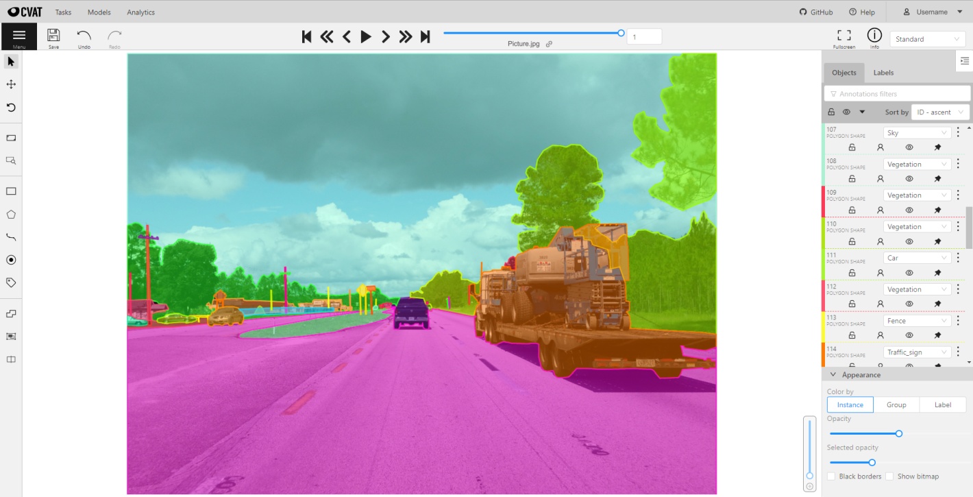
The problem is defined as the need to detect invasive plants like knotweed and prevent it from destroying the crops and plants. This entails leveraging technology to identify objects or features within the images which then can help detect the exact position.
Automate Surveying
From drone images or mobile phone images, we can detect and count plants and and other objects of interest in the field. Computer vision models transform the images into data that can be used for decision making.
Simplify Model Training
Data pipelines are created to preprocess the images and labels, and to train the models. The models are then deployed to the cloud for inference. This allows domain experts to focus on the problem and not the technology.